Trail On foot Taufers im Münstertal - Tubre - Via Alpina Red R68 - Photo

Tous les sentiers balisés d’Europe PRO

© OpenStreetMap contributors
Length
Length
15.2 km
Max alt
Max alt
2300 m
Uphill gradient
Uphill gradient
1058 m
Km-Effort
Km-Effort  
27 km
Min alt
Min alt
1244 m
Downhill gradient
Downhill gradient
489 m
Boucle
Boucle
No
Signpost
Signpost
Creation date :
2022-02-17 11:11:53.661
Updated on :
2022-03-02 02:59:11.858

(0 Reviews)

On foot
On foot
6h14
Difficulty : Medium

Scan this QR Code to open this trail in the SityTrail application

FREE GPS app for hiking

Logo SityTrail SityTrail

IGN / Geographical institutes

Download SityTrail from the App Store Download SityTrail from Google Play

Logo SityTrail SityTrail World

The world is yours!

Download SityTrail from the App Store Download SityTrail from Google Play Download SityTrail on Huawei AppGallery

About

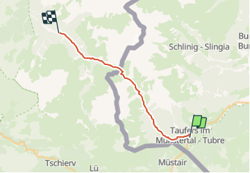
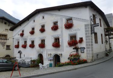
Trail On foot of 15.2 km to be discovered at Trentino-Alto Adige/Südtirol, South Tyrol, Taufers im Münstertal - Tubre. This trail is proposed by SityTrail - itinéraires balisés pédestres.

Description

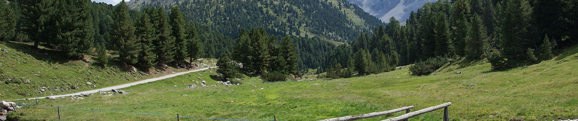
Leave S-charl in a southeastern direction and follow the valley floor to Plan d'Immez. From here, turn into the Val Plazer. The trail leads over the Cruschetta/S-charljöchl pass to the Swiss-Italian border. First head on a somewhat steeper downward course and then take an easy meadow trail through the solitary Avignatal valley (with its rare flowers and view over the Ortler) out to Taufers i. M.

Website: http://via-alpina.org/en/stage/248

Photos

Positioning

Country:
Italy
Region :
Trentino-Alto Adige/Südtirol
Department/Province :
South Tyrol
Municipality :
Taufers im Münstertal - Tubre
Location:
Unknown
Start:(UTM)
611994 ; 5166663 (32T) N.

Trails nearby

Trail On foot Val Müstair - Sta. Maria - Pass Umbrail - Photo
On foot
PRO

On foot

Easy
Val Müstair, Grisons, Region Engiadina Bassa/Val Müstair, Switzerland
8.4 km | 19.6 km-effort
4h 27min
No
Trail On foot Val Müstair - Senda Trafögl - Photo
On foot
PRO

On foot

Easy
Val Müstair, Grisons, Region Engiadina Bassa/Val Müstair, Switzerland
5.5 km | 9.3 km-effort
2h 6min
Yes
Trail On foot Val Müstair - Stundenweg - Photo
On foot
PRO

On foot

Medium
Val Müstair, Grisons, Region Engiadina Bassa/Val Müstair, Switzerland
18.2 km | 29 km-effort
6h 38min
No
Trail Other activity Val Müstair - Kreuz und quer im Val Müstair - Photo
Other activity
bffcuc

Other activity

Very easy
Val Müstair, Grisons, Region Engiadina Bassa/Val Müstair, Switzerland
27 km | 41 km-effort
7h 23min
Yes
Trail Mountain bike Val Müstair - WallisBike 20 Santa Maria - Scuol - Photo
Mountain bike
ovronne

Mountain bike

Very easy
Val Müstair, Grisons, Region Engiadina Bassa/Val Müstair, Switzerland
50 km | 76 km-effort
4h 39min
No
Trail Other activity Val Müstair - Val Müstair Talrunde - Photo
Other activity
bffcuc

Other activity

Very easy
Val Müstair, Grisons, Region Engiadina Bassa/Val Müstair, Switzerland
18.2 km | 26 km-effort
Unknown
Yes
Trail Other activity Val Müstair - Sella da Piz Cotschen - Photo
Other activity
bffcuc

Other activity

Very easy
Val Müstair, Grisons, Region Engiadina Bassa/Val Müstair, Switzerland
23 km | 44 km-effort
Unknown
Yes
Trail Other activity Val Müstair - Piz Lad via Lai da Rims - Photo
Other activity
bffcuc

Other activity

Very easy
Val Müstair, Grisons, Region Engiadina Bassa/Val Müstair, Switzerland
21 km | 41 km-effort
Unknown
Yes
Trail Other activity Val Müstair - Sta. Maria - Lü - Süsom Givè - Photo
Other activity
bffcuc

Other activity

Very easy
Val Müstair, Grisons, Region Engiadina Bassa/Val Müstair, Switzerland
18.6 km | 31 km-effort
Unknown
No


Close
My subscriptions